The Population of the UK and of England
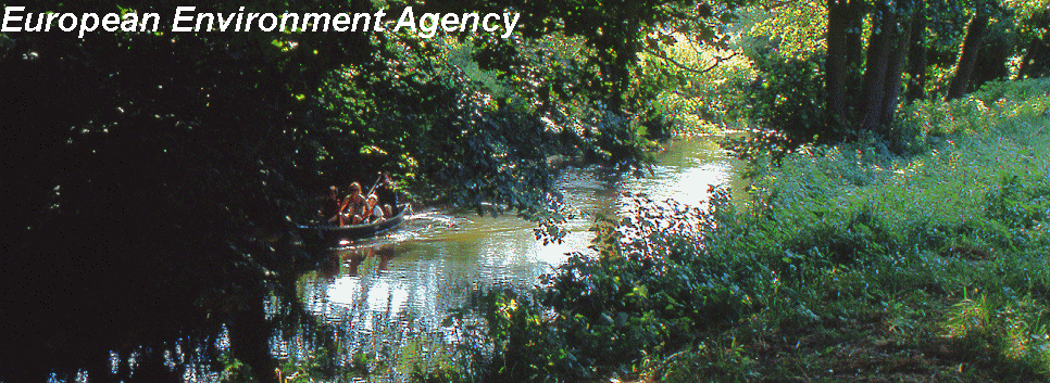
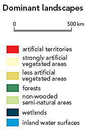
The population of the UK is very high relative to the land area.At the April 2001 census, the United Kingdom's population was 58,789,194, the third-largest in the European Union (behind Germany and France) and the twenty-first largest in the world. Its overall population density is one of the highest in the world. Almost one-third of the population lives in England's prosperous south-east and is predominantly urban and suburban--with about 7.2 million in the capital of London. The United Kingdom's high literacy rate (99%) is attributable to universal public education introduced for the primary level in 1870 and secondary level in 1900 (except in Scotland where it was introduced in 1696). Education is mandatory from ages five through sixteen. http://en.wikipedia.org/wiki/United_Kingdom The UK includes Northern Ireland, whereas Great Britain does not. England's population density is currently 383 people per square kilometre making it one of the most densely populated countries on Earth. In Europe England is the second most densely populated country after the Netherlands. England has more than three times the density of population of France. (with global warming we will need to accommodate a large number of Dutch people as Holland will be reclaimed by the sea!) UK data quotation from the remarkable Wikipedia online encyclopaedia I think you should include data on individual UK countries: England, Scotland, Wales and Northern Ireland. Although part of the UK they are individual countries (with their own flags, anthems, identities, even rugby and soccer teams). However they should be included separately mostly because there is such a huge difference in density - England has 382 people /sq. km. making it one of the most densely populated in the world, while Scotland has only 64. The data for each (2001/2002 census data) is as follows: England 130,326 sq km pop: 49,855,700 = 382 people/km² Scotland 83,859 sq km pop: 5,683,062 = 64 people/km² Wales 20,779 sq km pop: 2,918,700 = 140 people/km² Northern Ireland 14,139 sq km pop: 1,702,600 = 120 people/km² http://en.wikipedia.org/wiki/Talk:List_of_countries_by_population_density Land Use Urbanisation UKThis statistical information lends even greater support for protecting our countryside from increasing urbanisation. The European Environment Agency (click cancel if you get a password window!) has a wealth of information on Europe that makes fascinating reading. In particular, the maps that show the relative amount of land use. From those maps it is possible to make the following observations: 1. Although the UK does not have the highest concentration of artificial territories, it still has more than France, Italy, Spain, Portugal and most of Eastern Europe 2. The UK has more strongly artificial vegetated areas than most of Europe 3. The UK also has very little less artificial vegetated areas compared to other European countries 4. The UK has almost no forest compared to other European countries 5. Also the UK has very little non-wooded semi-natural areas compared to other European countries 6. and not many areas of inland water surfaces and wetlands NB: Land use terminology in the EEA maps source: reports.eea.eu.int/92-9157-202-0/en/3.13.pdf or 3.13. Rural areas - our link to the land If you need Adobe Acrobat Reader visit for a free download: http://www.adobe.com/support/products/acrreader.html
|
|
 |
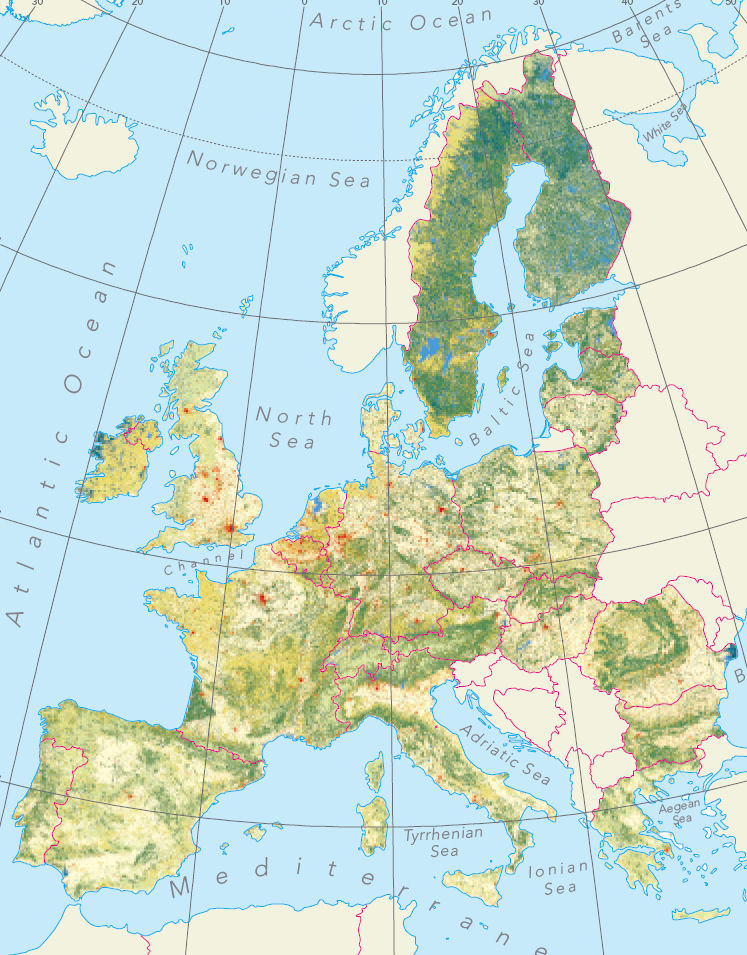 |
Further CommentBristol and Bath are quite near to Freshford. Bristol is the 40th most populated settlement in the UK. If the London boroughs are taken away from the statistics Bristol becomes within the top ten most densely populated settlements. Population density England 377 persons per sq km http://en.wikipedia.org/wiki/England Land that surrounds cities and town that have a large population need to have decent countryside around them this provides for recreation and contributes to reducing stress. The historical argument for establishing the green belts can be read hereFor an interpretation of this EEA map the red areas are built up. The lighter the colour used the more artificial the land use. This information is quantitative, quality of land use is absent, for example, we have some wonderful wild life protective areas, even though we do not have so many acres or hectares as other European countries. The geophysical nature of the land is also important. One would hardly expect Sweden and Finland to have large amounts of strongly artificial vegetated areas as those countries are located at high latitudes which are more suited to forestry. France is most interesting, but has a lot of high land and has a much lower density of population. How did they manage that? Ireland looks interesting as well - but we all know it rains even more over there!
|
|
| Reflecting on the essential facts that are presented here, it is surely reasonable to conclude that the UK and in particular England needs whatever wild or semi-wild or rural land it has BECAUSE IT DOES NOT HAVE MUCH! and that this land is particularly important near large urban conurbations e.g., Bristol and Bath. Particularly Bristol. | |